Peddars Way and Norfolk Coast Path XT40 Harvey Map
Guidepost price £15.95
In stock
SKU
02-NTM-049
This is a complete map of the Peddars Way and Norfolk Coast Path National Trail Paths.
The Peddars Way is steeped in ancient legend and is 134km (83.5 miles) long. It starts at Knettishall Heath, linking the forests and heathland of the Brecks and finishing on the coast at Holme-next-the-Sea.
The Norfolk Coast Path is a beautiful walk among sand dunes, marshes and Nature Reserves, and is 74km (46 miles) long. It starts at Hunstanton and goes through the North Norfolk Area of Oustanding Natural Beauty before finishing at Hopton on Sea
Combining both Peddars Way and the Norfolk Coast Path is a moderate long-distance walk that takes most people 7-10 days to complete but can be easily broken into shorter walks. It is considered by many to be one of the most accessible National Trails, making it a perfect trail for first time long-distance walkers, or one for the winter months due to Norfolk's dry climate.
The map includes logistical information for walking the Peddars Way and Norfolk Coast Path, including accommodation options, shops and refreshments. Directions to the start of the route are included plus enlargements of the local towns and villages showing what facilities are available.
Harvey XT40 Maps are printed on light, waterproof and tear-resistant synthetic paper, and it is GPS compatible. The map key and legend is in English, French and German text.
Scale is:1:40,000
ISBN is: 9781851376292
ISBN is: 9781851376292
We found other products you might like!
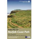
- Peddars Way and Norfolk Coast Path Official GuidebookGuidepost price £14.99
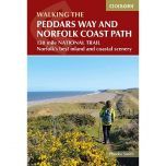
- Peddars Way and Norfolk Coast Path Cicerone GuidebookGuidepost price £12.95
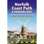
- Norfolk Coast and Peddars Way Trailblazer GuidebookGuidepost price £14.99


