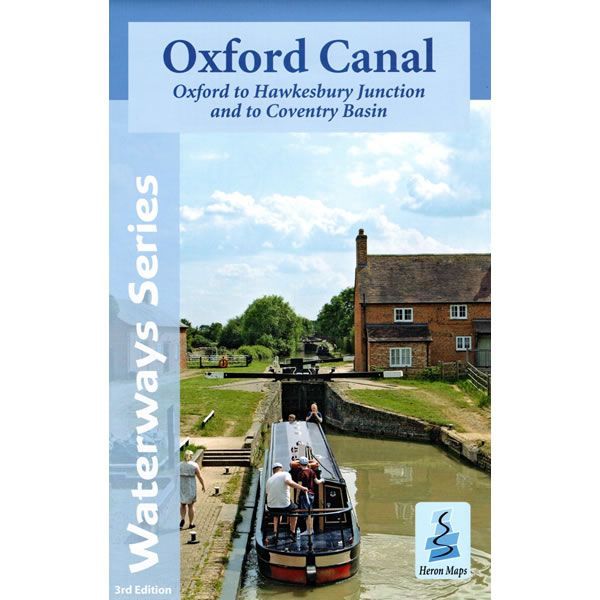
Oxford Canal Heron Map
This Heron waterways map covers the whole of the Oxford Canal, plus the Coventry Canal all the way to Coventry. The map provides detailed information for both waterways and leisure users, and it is complimented by information panels and photographs.
The Oxford Canal starts at Oxford and finishes at the Hawksebury Junction on the Coventry Canal. The map then continues along the Coventry Basin into the heart of the city. This route has a unique charm, twisting and turning from the outskirts of Coventry, through glorious tranquil countryside, past picturesque canal side villages to the dreaming spires of Oxford, helping to make it one of the most popular cruising routes in Britain.
This cruising and tourist map of the Oxford Canal and part of the Coventry Canal is at a scale of 1:50,000. There are detailed town plans of Oxford, Banbury and Braunston at a scale of 1:12,500.
The map includes navigation and historical information, visitor moorings, marinas and boatyards, boat hire centres, facilities for the boat user, shops, post offices and distance markers. Information for the tourist includes tourist information centres, places of interest, pubs, nature reserves, parks, churches, long distance paths, public toilets, plus caravan and camp sites.
Published by Heron Maps in May 2023 this is the revised 3rd edition of this map.
-
 Oxford and Grand Union Pearson Canal CompanionGuidepost price £14.95
 -
 Canal and River Cruising Planner of Great BritainGuidepost price £5.99
 -
 River Thames and the Thames Path Heron MapGuidepost price £5.99