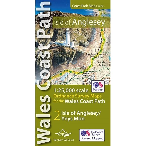
Isle of Anglesey Coast Path Atlas
Guidepost price £9.99
In stock
SKU
30-ZZZ-002
This Isle of Anglesey Coast Path Atlas provides all the mapping you need to walk a complete circuit of the Anglesey section of the Wales Coast Path at a scale of 1:25,000. It uses OS mapping covering the complete circuit of the Isle of Anglesey from the Menai Bridge. Additional map symbols show tea shops, cafes, extra parking, and public toilets at the main towns and villages.
At the start of the booklet there is a brief introduction to Anglesey includes a fascinating photo mosaic highlighting notable views, places of interest and wildlife you’ll meet along the way. There is also a section of detailed Useful Information at the back of the atlas.
The laminated flapped covers show the Wales Coast Path signs and waymarkers, route details and map symbols make this Isle of Anglesey Coast Path Atlas simple and easy to use.
Scale is:1:25,000
ISBN is: 9781908632593
Size is: 107mm x 215mm
Number of pages is: 48
ISBN is: 9781908632593
Size is: 107mm x 215mm
Number of pages is: 48
We found other products you might like!
-
 Wales Coast Path Cicerone GuidebookGuidepost price £13.95
 -
 Llyn Peninsula Coast Path MapGuidepost price £9.99