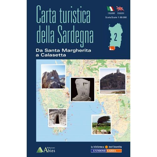
Santa Margherita to Calasetta walking map
Guidepost price £8.95
In stock
SKU
10-SAR-002
This Da Santa Margherita a Calasetta walking map covers many walking, hiking and cycling paths and trails along the coastal from Santa Margherita (west of Cagliari) to Calasetta on the island of Sant’ Antioco, and north as far as Carbonia. This is the most southern part of Sardinia and it includes the Sulcis Mountains, where you will find forests, mountains of great charm and a wonderful coastline, including the Gulf of Palmas.
The whole map is in English and Italian text including detailed descriptions of the various archaeological sites, churches, monuments, museums and beaches that are shown on this map of Da Santa Margherita a Calasetta. It also describes a number of graded walking and cycling routes.
Published by Edizioni Abies this is map number 2 out of a series of 12 maps that cover the whole coast of Sardinia. The map legend/key is in Italian, German, French, and English text.
Scale is:1:60,000
ISBN is: 9788898551033
ISBN is: 9788898551033
We found other products you might like!
-
![Gulf of Oristano walking map [4]](https://www.guidepost.uk.com/pub/media/catalog/product/cache/dadd9a99528695eab1f8fe8a8f1ff559/0/4/04-gulf-of-oristano-walking-map.jpg) Gulf of Oristano walking map [4]Guidepost price £8.95
Gulf of Oristano walking map [4]Guidepost price £8.95 -
![Cagliari and Gulf of Cagliari walking map [1]](https://www.guidepost.uk.com/pub/media/catalog/product/cache/dadd9a99528695eab1f8fe8a8f1ff559/0/1/01-cagliari-and-gulf-of-cagliari-walking-map_2.jpg) Cagliari and Gulf of Cagliari walking map [1]Guidepost price £8.95
Cagliari and Gulf of Cagliari walking map [1]Guidepost price £8.95