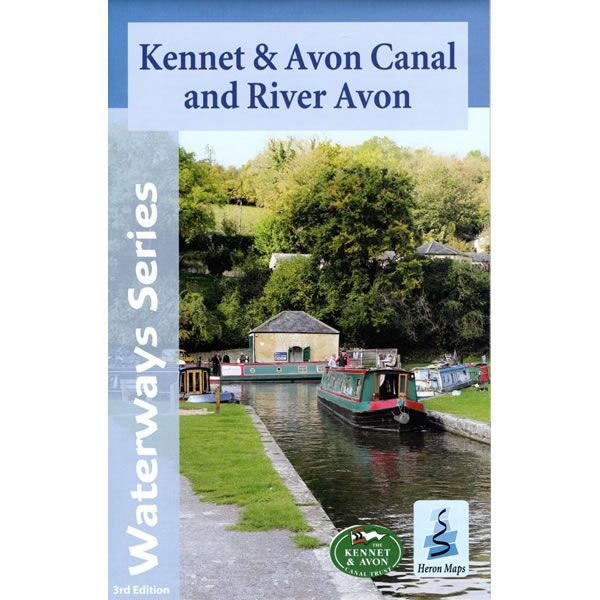
Kennet and Avon Canal, and the River Avon Heron Map
This Heron waterways map covers the Kennet and Avon Canal, plus the River Avon running from Bristol in the west to Reading and the junction with the River Thames in the east. The map provides detailed information for both waterways and leisure users, and it is complimented by information panels and photographs.
The Kennet and Avon Canal is the most southerly broad beam canal in England. With a rich industrial heritage, spectacular scenery, and abundance of wildlife it is a great way to explore a relatively unspoilt corridor of southern England.
This cruising and tourist map of the Kennet and Avon Canal, plus River Avon is at a scale of 1:50,000. There are detailed town plans at a scale of 1:12,500 for Bristol, Bath, Bradford-on-Avon, Devizes, Newbury, Hungerford and the centre of Reading.
The map includes navigation and historical information, visitor moorings, marinas and boatyards, boat hire centres, facilities for the boat user, shops and distance markers. The National Cycle Route 4 and crossing routes are also shown between Reading and Bristol.
Information for visitors includes tourist information centres, places of interest, pubs, nature reserves, parks, churches, long distance footpaths, public toilets and caravan and camp sites.
Published by Heron Maps (revised 3rd edition) in November 2021.
-
 Avon Ring and Droitwich Ring Heron MapGuidepost price £6.50
 -
 Kennet and Avon Pearson Canal CompanionGuidepost price £11.95
 -
 Severn and Avon Pearson Canal CompanionGuidepost price £11.95