Four Counties Ring Heron Map
Guidepost price £6.50
In stock
SKU
01-HER-017
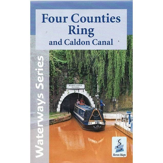
This Heron waterways map covers the Four Counties Ring and Caldon Canal including the Shropshire Union Canal from Beeston to Autherley Junction, parts of the Staffordshire and Worcestershire Canal, and Trent and Mersey Canal, and the Middlewich Branch. The Four Counties Ring passes largely through rural and open countryside, a few market towns and the heart of the Potteries. The map provides detailed information for both waterways and leisure users, and it is complimented by information panels and photographs.
This cruising and tourist map of the Four Counties Ring and Caldon Canal is at 1:50,000. Also included are with detailed town plans for Brewood, Market Drayton, Audlem, Nantwich, Middlewich, Kidsgrove, Etruria and Hanley, Stone and Penkridge at a scale of 1:12,500.
The Four Counties Ring is a 110m mile route that typically starts at Autherley Junction, near Wolverhampton, on the Shropshire Union Canal. It heads north through deep cuttings, high embankments and a charmingly rural landscape enjoying many lock free miles.
Just north of Nantwich the route heads east from Barbridge Junction along the Middlewich Branch maintaining its rural feel. On arriving in Middlewich the route passes through Wardle Lock and along the 154 ft (47 m) Wardle Canal, the shortest in the UK, before joining the Trent & Mersey Canal.
Turning south the route heads past Sandbach and ascends 'Heartbreak Hill', a series of 26 locks, offering panoramic views across the Cheshire Plain. At Kidsgrove it passes through the Harecastle Tunnel, 5th longest in the UK, emerging to the urban landscape of Stoke-on-Trent.
The route continues south to Great Haywood Junction, before heading westwards, along the meandering Staffordshire & Worcestershire Canal, skirting the southern edge of Stafford, climbing towards Penkridge and then Gailey, at the end of the summit pound, before a lock free section back to Autherley Junction.
It is possible to complete this 110 mile ring in a week, but ideally more time should be allowed to enjoy its charms, such as a detour along the picturesque Caldon Canal at Stoke, through the Churnet Valley towards the Peak District.
The map includes navigation and historical information, visitor moorings, marinas, boatyards and boat hire centres with contact details, facilities for the boat user, sailing and boat clubs, shops, post offices and distance markers. Information for the tourist includes tourist information centres, places of interest, pubs, nature reserves, parks, churches, national cycle routes, long distance paths, public toilets and caravan and camp sites.
Published by Heron Maps in 2016.
ISBN is: 9781908851154
We found other products you might like!
-
 Canal and River Cruising Planner of Great BritainGuidepost price £5.99
 -
 Four Counties Ring Pearson Canal CompanionGuidepost price £11.95