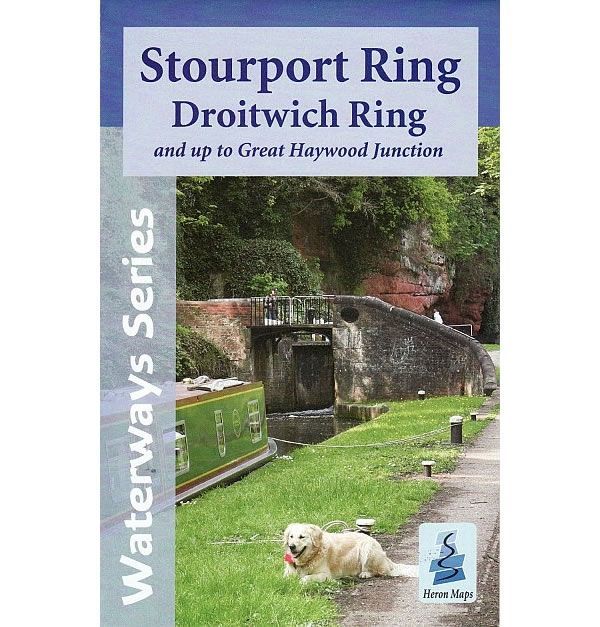
Stourport Ring and Droitwich Ring Heron Map
Guidepost price
In stock
SKU
01-HER-011
This Heron waterways map covers the Stourport and Droitwich Rings through the heart of the West Midlands. It also includes the whole of the Staffordshire and Worcestershire Canal up to Great Haywood Junction where it joins the Trent and Mersey Canal. The map provides detailed information for both waterways and leisure users, and it is complimented by information panels and photographs.
The Stourport Ring, slightly more triangular than circular, has a city on each apex. Starting from Aldersley Junction in Wolverhampton the route heads down the Birmingham Canal Navigations into Birmingham, before turning south and travelling the entire length of the Worcester and Birmingham Canal to Worcester. At Worcester it turns north and heads up the River Severn to Stourport-upon-Severn. It then returns to Aldersley Junction along the Staffordshire and Worcestershire Canal, the entire length of which is shown on this map, up to Great Haywood Junction where it joins the Trent and Mersey Canal.
The Droitwich Ring is made up of the Droitwich Barge and Droitwich Junction Canals, the River Severn between Hawford and Diglis on the outskirts of Worcester, and the bottom section of the Worcester and Birmingham between Diglis and Hanbury Junction.
This cruising and tourist map of the Stourport and Droitwich Rings is at a scale of 1:50,000. Also included are detailed town plans of Wolverhampton, Tipton, Droitwich Spa, Worcester, Stourport-on-Severn, Kidderminster and Penkridge at a scale of 1:12500. An additional plan showing the heart of Birmingham at a scale of 1:10,000 is also included.
The map includes navigation and historical information, visitor moorings, marinas and boatyards, boat hire centres, facilities for the boat user, shops, post offices and distance markers. Information for the tourist includes tourist information centres, places of interest, pubs, nature reserves, parks, churches, long distance paths, public toilets, plus caravan and camp sites.
Published by Heron Maps in 2013.
ISBN is: 9781908851086
We found other products you might like!
-
 Avon Ring and Droitwich Ring Heron MapGuidepost price £6.50
 -
 Severn and Avon Pearson Canal CompanionGuidepost price £11.95
 -
 Canal and River Cruising Planner of Great BritainGuidepost price £5.99